Distrikt i Sri Lanka – 25 administrativa indelningar i 9 provinser
Upptäck Sri Lankas 25 distrikt och deras roll i landets 9 provinser – översikt över administrativa indelningar, distriktssekreterare och regional organisation.
I Sri Lanka är distrikt (singalesiska: දිස්ත්රික්ක, tamilska: மாவட்டம்) administrativa indelningar på andra nivån. Den första nivån är provinserna. Varje provins innehåller ett antal distrikt. Det finns 25 distrikt i landet. De är organiserade i 9 provinser. Varje distrikt administreras under en distriktssekreterare. Sekreterarna utses av centralregeringen.
Distrikten har rötter i kolonialadministrationen och utgör idag viktiga enheter för statlig service, lokal planering, katastrofberedskap och registerföring av mark och folkbokföring. Den ansvariga tjänstemannen kallas idag district secretary (tidigare ofta kallad Government Agent) och leder distriktets District Secretariat. Distrikten delas i sin tur i mindre enheter, främst Divisional Secretariats (tidigare kallade DS-divisioner) och längst ner i hierarkin finns Grama Niladhari-områden (lokala byadministrationer).
Bildgalleri
8 Bilder

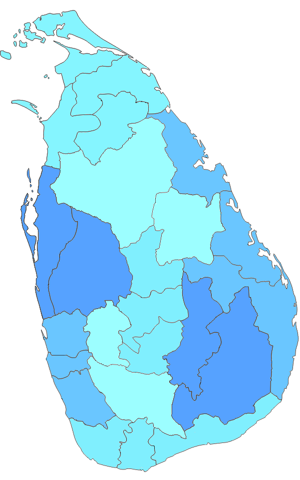


Lista över distrikt efter provins
- Western Province: Colombo, Gampaha, Kalutara
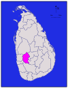
- Central Province: Kandy, Matale, Nuwara Eliya
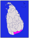
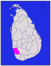
- Southern Province: Galle, Matara, Hambantota
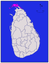
- Northern Province: Jaffna, Kilinochchi, Mannar, Mullaitivu, Vavuniya
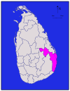
- Eastern Province: Trincomalee, Batticaloa, Ampara
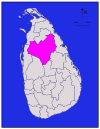
- North Central Province: Anuradhapura, Polonnaruwa
- North Western Province: Kurunegala, Puttalam
- Sabaragamuwa Province: Ratnapura, Kegalle
- Uva Province: Badulla, Monaragala
Varje distrikt har en huvudort (administrativt centrum) där District Secretariat vanligtvis är beläget. Storlek, befolkning och ekonomi varierar starkt mellan distrikten — från tätbefolkade kustnära områden som Colombo till stora inland- och odlingsdistrikt som Anuradhapura och Monaragala. Distrikten spelar också en viktig roll i etikettering av statistik, valkretsar och offentlig service.
För den som vill fördjupa sig rekommenderas att titta på officiella kartor och källor från Sri Lankas regering för uppdaterade uppgifter om administrativa gränser, befolkningsstatistik och lokala myndigheters organisation.
Distrikt
Alla befolkningssiffror är från den senaste folkräkningen i Sri Lanka 2012. Befolkningstätheten har beräknats med hjälp av landarealen i stället för den totala arealen (den totala arealen skulle ha inkluderat arealen av floder och sjöar).
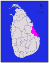
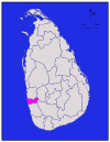
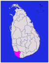
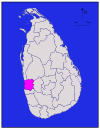
| Distrikt | Karta över området | Provins | Distriktets |
|
| Total | Befolkning |
|
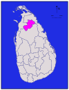
| Ampara |
| Östra | Ampara | 4,222 (1,630) | 193 (75) | 4,415 (1,705) | 648,057 | 153 (400) |
| Anuradhapura |
| Norra Central | Anuradhapura | 6,664 (2,573) | 515 (199) | 7,179 (2,772) | 856,232 | 128 (330) |
| Badulla |
| Uva | Badulla | 2,827 (1,092) | 34 (13) | 2,861 (1,105) | 811,758 | 287 (740) |
|
| Östra | Batticaloa | 2,610 (1,010) | 244 (94) | 2,854 (1,102) | 525,142 | 201 (520) | |
|
| Västra | Colombo | 676 (261) | 23 (8.9) | 699 (270) | 2,309,809 | 3,417 (8,850) | |
| Galle |
| Södra | Galle | 1,617 (624) | 35 (14) | 1,652 (638) | 1,058,771 | 655 (1,700) |
| Gampaha |
| Västra | Gampaha | 1,341 (518) | 46 (18) | 1,387 (536) | 2,294,641 | 1,711 (4,430) |
| Hambantota |
| Södra | Hambantota | 2,496 (964) | 113 (44) | 2,609 (1,007) | 596,617 | 239 (620) |
|
| Norra | 929 (359) | 96 (37) | 1,025 (396) | 583,378 | 628 (1,630) | ||
| Kalutara |
| Västra | Kalutara | 1,576 (608) | 22 (8.5) | 1,598 (617) | 1,217,260 | 772 (2,000) |
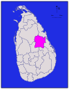
| Kandy |
| Kandy | 1,917 (740) | 23 (8.9) | 1,940 (750) | 1,369,899 | 715 (1,850) | |
| Kegalle |
| Sabaragamuwa | Kegalle | 1,685 (651) | 8 (3.1) | 1,693 (654) | 836,603 | 497 (1,290) |
|
| Norra | Kilinochchi | 1,205 (465) | 74 (29) | 1,279 (494) | 112,875 | 94 (240) | |
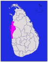
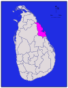
| Kurunegala |
| Nordväst | Kurunegala | 4,624 (1,785) | 192 (74) | 4,816 (1,859) | 1,610,299 | 348 (900) |
|
| Norra | Mannar | 1,880 (730) | 116 (45) | 1,996 (771) | 99,051 | 53 (140) | |
| Matale |
| Matale | 1,952 (754) | 41 (16) | 1,993 (770) | 482,229 | 247 (640) | |
| Matara |
| Södra | Matara | 1,270 (490) | 13 (5.0) | 1,283 (495) | 809,344 | 637 (1,650) |
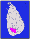
| Moneragala |
| Uva | Moneragala | 5,508 (2,127) | 131 (51) | 5,639 (2,177) | 448,142 | 81 (210) |
|
| Norra | Mullaitivu | 2,415 (932) | 202 (78) | 2,617 (1,010) | 91,947 | 38 (98) | |
| Nuwara Eliya |
| Nuwara Eliya | 1,706 (659) | 35 (14) | 1,741 (672) | 706,588 | 414 (1,070) | |
| Polonnaruwa |
| Norra Central | Polonnaruwa | 3,077 (1,188) | 216 (83) | 3,293 (1,271) | 403,335 | 131 (340) |
| Puttalam |
| Nordväst | Puttalam | 2,882 (1,113) | 190 (73) | 3,072 (1,186) | 759,776 | 264 (680) |
| Ratnapura |
| Sabaragamuwa | Ratnapura | 3,236 (1,249) | 39 (15) | 3,275 (1,264) | 1,082,277 | 334 (870) |
|
| Östra | Trincomalee | 2,529 (976) | 198 (76) | 2,727 (1,053) | 378,182 | 150 (390) | |
|
| Norra | Vavuniya | 1,861 (719) | 106 (41) | 1,967 (759) | 171,511 | 92 (240) | |
| Totalt | 62,705 (24,211) | 2,905 (1,122) | 65,610 (25,330) | 20,263,723 | 323 (840) |


Frågor och svar
F: Vad är distrikt i Sri Lanka?
S: I Sri Lanka är distrikt den andra nivån av administrativa indelningar.
F: Vad är den första nivån av administrativa indelningar i Sri Lanka?
S: Den första nivån av administrativa indelningar i Sri Lanka är provinserna.
F: Hur många distrikt finns det i Sri Lanka?
S: Det finns 25 distrikt i Sri Lanka.
F: Hur många provinser finns det i Sri Lanka?
S: Det finns 9 provinser i Sri Lanka.
F: Vem administrerar varje distrikt i Sri Lanka?
S: Varje distrikt i Sri Lanka administreras av en distriktssekreterare.
F: Vem utser distriktssekreterarna i Sri Lanka?
S: Centralregeringen utser distriktssekreterarna i Sri Lanka.
F: Vilka är namnen på de administrativa indelningarna på singalesiska och tamilska i Sri Lanka?
S: De administrativa indelningarna i Sri Lanka är kända som "දිස්ත්රික්ක" på singalesiska och "மாவட்டம்" på tamilska.
Relaterade artiklar
Författare
AlegsaOnline.com Distrikt i Sri Lanka – 25 administrativa indelningar i 9 provinser Leandro Alegsa
URL: https://sv.alegsaonline.com/art/27771
Källor
- commons.wikimedia.org : Districts of Sri Lanka
- priu.gov.lk : "At a Glance"
- ds.gov.lk : "Vision & Mission" · web.archive.org
- archives.dailynews.lk : "Kilinochchi a brief look"